|
|
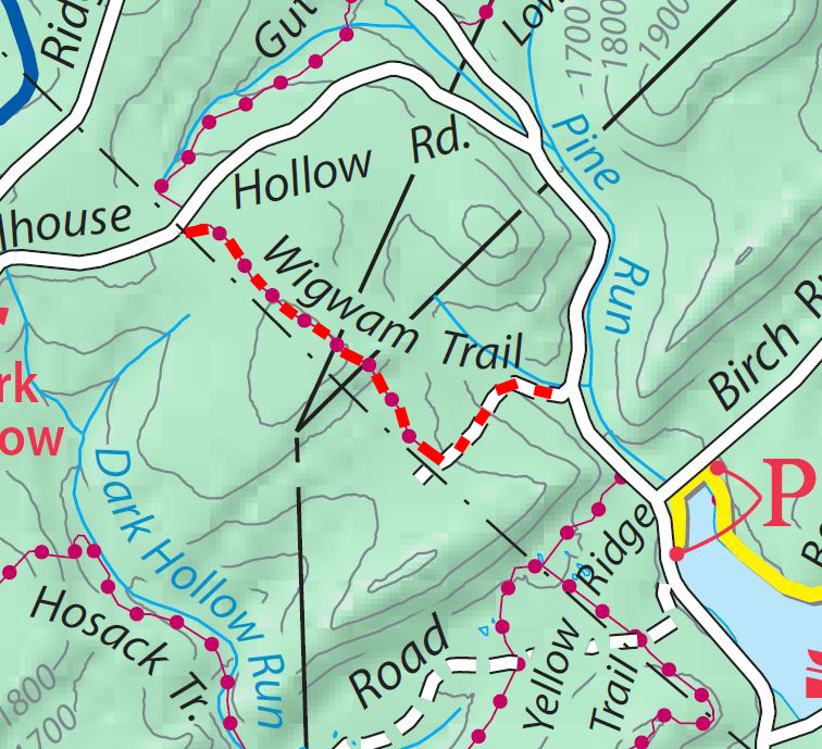
Michaux Trails map :
Trail Reports list
Use the link at left to return to the trails map.
Trail Report: Wigwam trailReporters: Mike Bertram Date: May 22, 2021 and 2025 Usage: foot and bike traffic. |
|
Recent Weather: dry Blazing: red Signage: at trail junctions Status: This trail has steep and eroded portions and also some entrenchment. At present the NW section of the trail goes through an active logging area and is difficult to follow in places. 2025: The section from the powerline to Milesburn road is mainly a stream bed with potholes that are hidden by stilt grass. Great care needs to be taken to transverse this section of trail. It should be closed. GPS Readings: Ends: 39.9451N, 77.4599W and 39.9508N, 77.4750W The trail is 1.2 miles long. |