Mine Report

Rock Candy Mountain Mine


Owners

Bossinger & Reed, Metler, El Toro Mg. Co,1


Mining District and Mines

Greaterville District - Cave Creek1


Location

20S, 15E NE¼ 8 NW¼ 91

31.44889,-110.784442


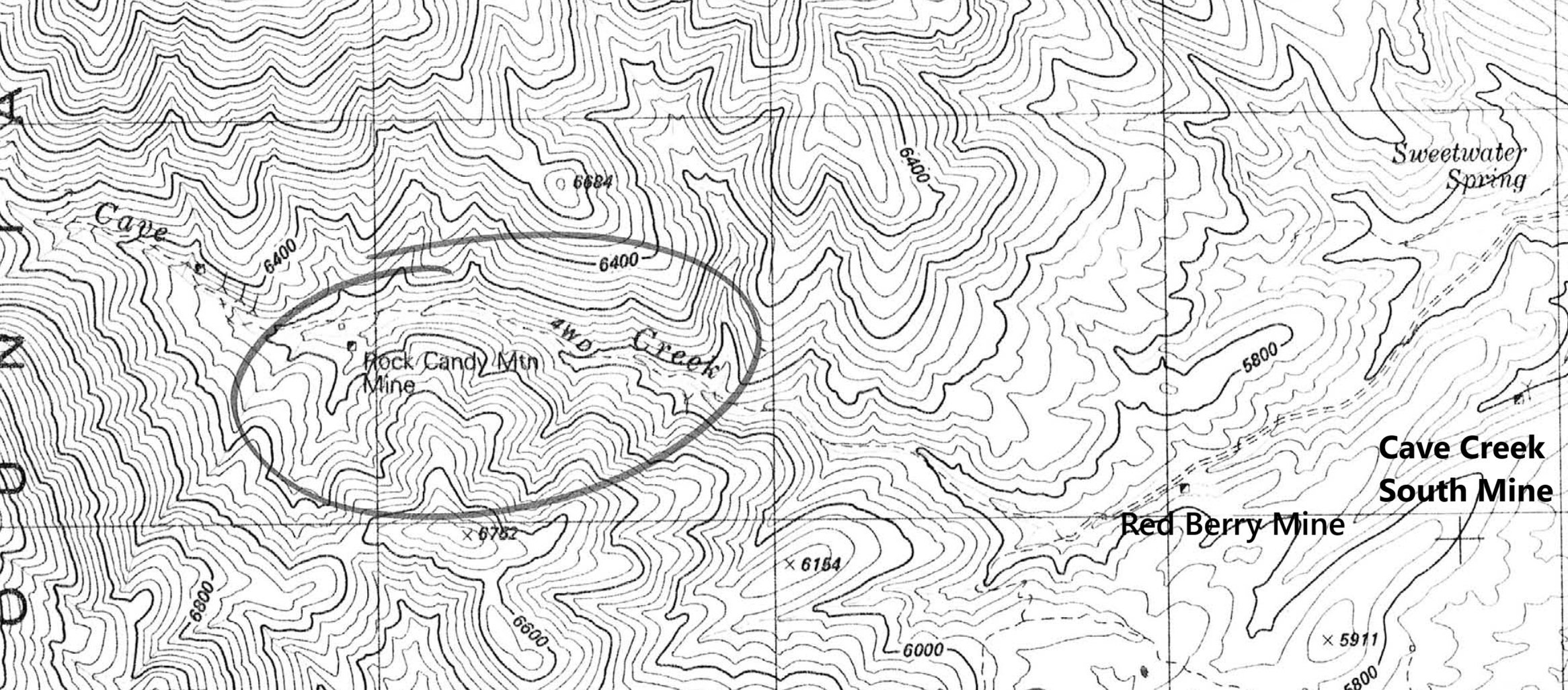
Topo map of mine area


Mineral Products

Cu, Ag, Pb-, Au-1


Geology

Spotty, irregular, largely oxidized, argentiferous copper mineralization along an intrusive contact of Triassic (?) quartz diorite and Triassic volcanics.1


Type of Operation and Production

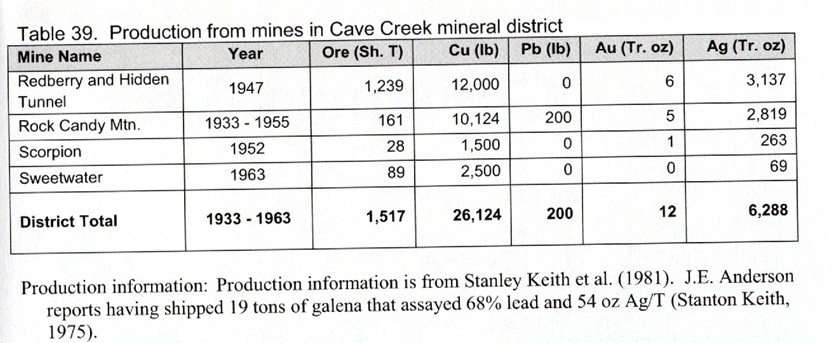
Shaft and tunnel operations. Worked intermittently from 1933 to 1955, producing some 125 tons of ore averaging about 6% Cu, 22 oz. Ag/T, and minor Pb and Au.1


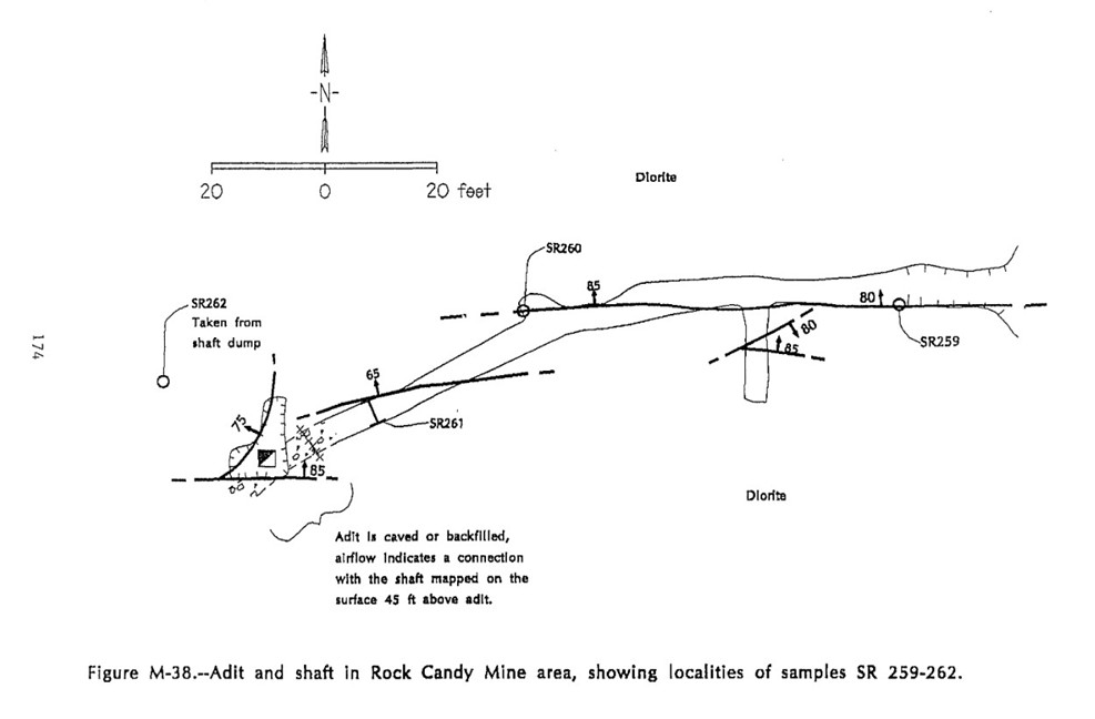
Plan 17


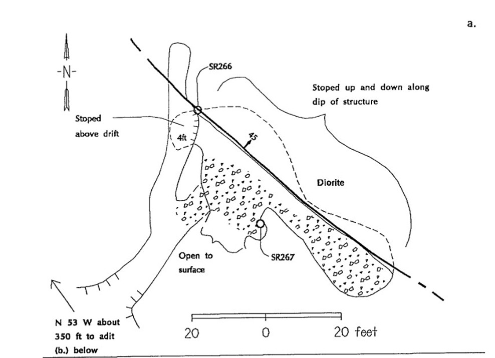
Plan 27


Plan 37


Production Figures8


Photos


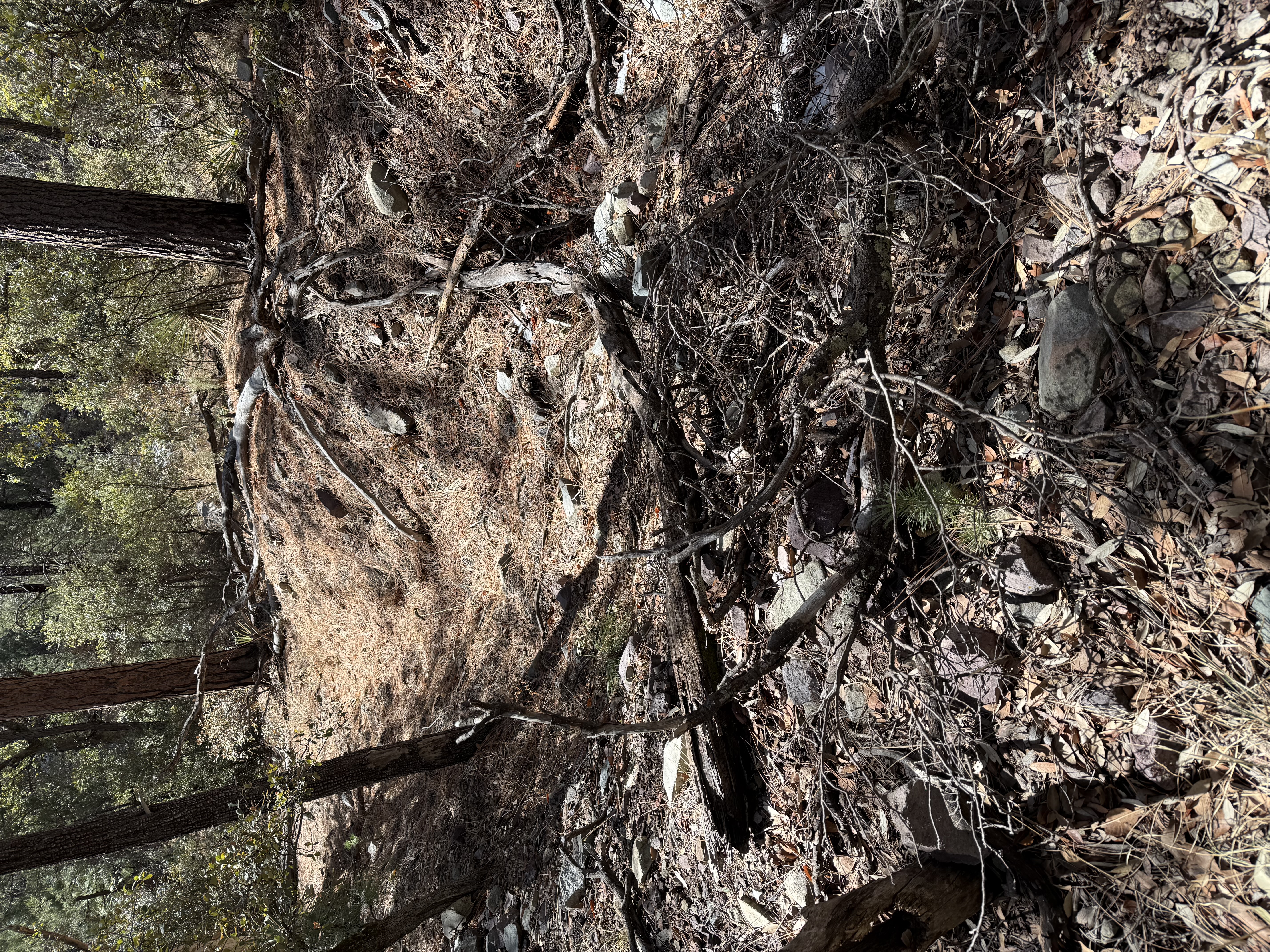
Manipulated Trench near Wilderness Boundary


References

  1. Index of Mining Properties in Santa Cruz County, Arizona, by Staton B. Keith, Bulletin 191, Arizona Geological Survey, 1975. Bulletin 191.
  2. Mindat.org - small amount of data
  3. MRDS records: 31.44904, -110.78538
  4. Mineral Appraisal of Coronado National Forest, Part 7 - Patagonia Mountains - Canelo Hills Unit by Mark Chatman, 1994, No entry
  5. Arizona Department of Mines report: http://docs.azgs.az.gov/OnlineAccessMineFiles/A-B/BilliedSantacruz65.pdf
  6. The Mineral Deposits of the Santa Rita and Patagonia Mountains by Frank C. Schrader, 1914 - no entry
  7. Mineral Appraisal of Coronado National Forest, Part 12, Santa Rita Mountains Unit Pima and Santa Cruz Counties, Arizona MLA 11-94